SPEL-96 Ltd. is a European geospatial engineering company with over three decades of experience in infrastructure surveying. Our work combines geodesy, 3D LiDAR processing and the development of software for integrated aerial and underwater operations.
Geodetic surveys, laser scanning, photogrammetry, spatial analysis and real estate valuation for private clients, businesses and public institutions.
High-precision setting out of highways, railways, bridges, dams, and underground networks. High-order deformation and structural displacement monitoring.
High-resolution UAV LiDAR scanning and digital photogrammetry. Generation of classified point clouds, DTM/DSM surfaces, and earthwork volume analysis.
Production and maintenance of cadastral maps and registers (KKKR). Development of detailed development plans (PUP) and infrastructure alignment schemes.
Architecture, database structuring, and deployment of specialized Geographic Information Systems for railway, energy, and municipal asset management.
Integrated surveying of water reservoirs, dam walls, harbors, and subsea structures utilizing multibeam sonars and acoustic-laser sensor fusion.
Expert forensic geodetic analysis, expropriation procedures, and technical advice for large-scale industrial and capital infrastructure investments.
Valuation of residential, commercial and industrial properties, land and agricultural land. Preparation of valuation reports tailored to the purpose of the assignment.
A trusted partner for state agencies, strategic operators, and international missions.
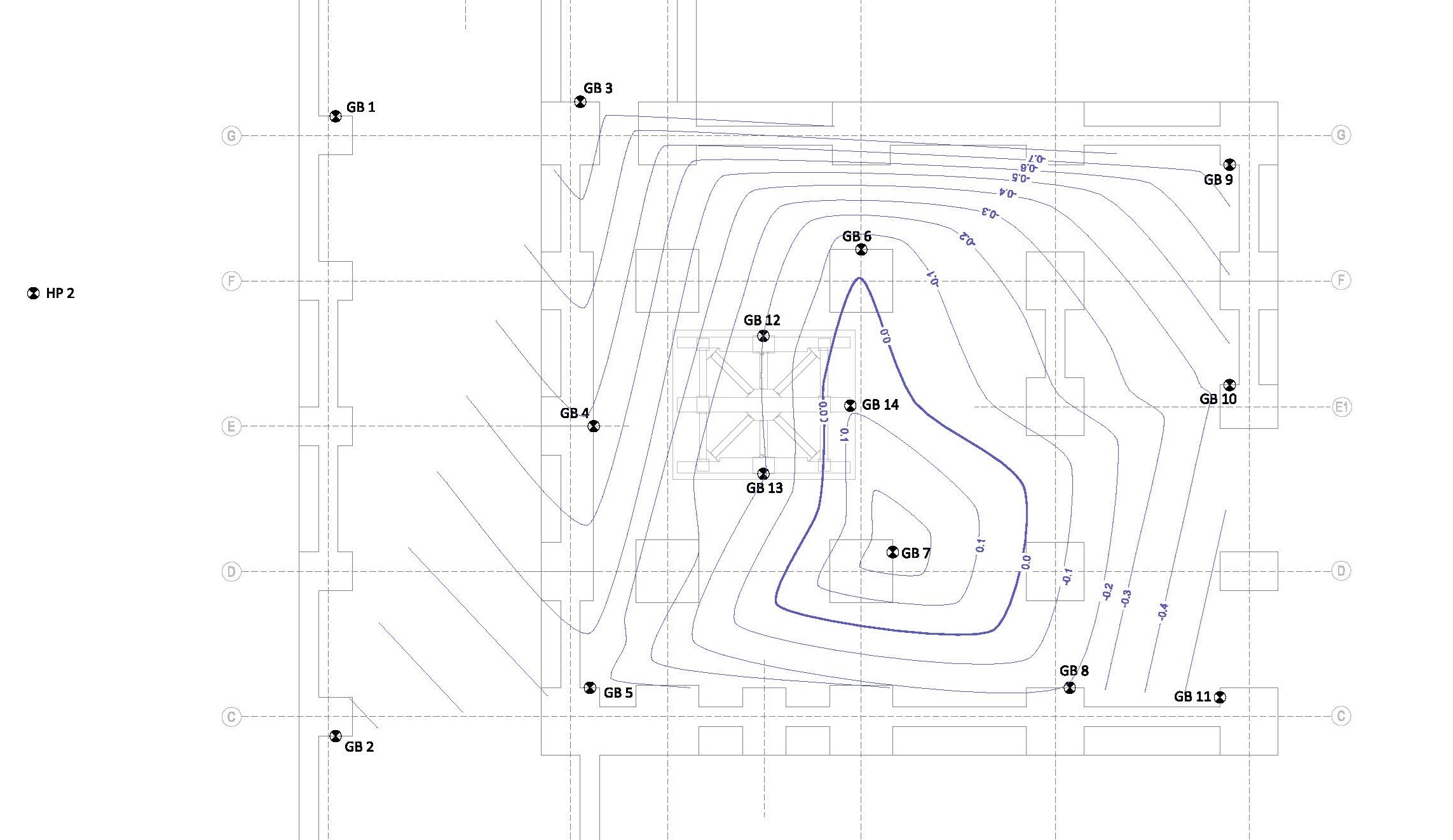
High-precision geodetic networks and contour analysis for structural displacement, industrial foundations, and dam stability verification.
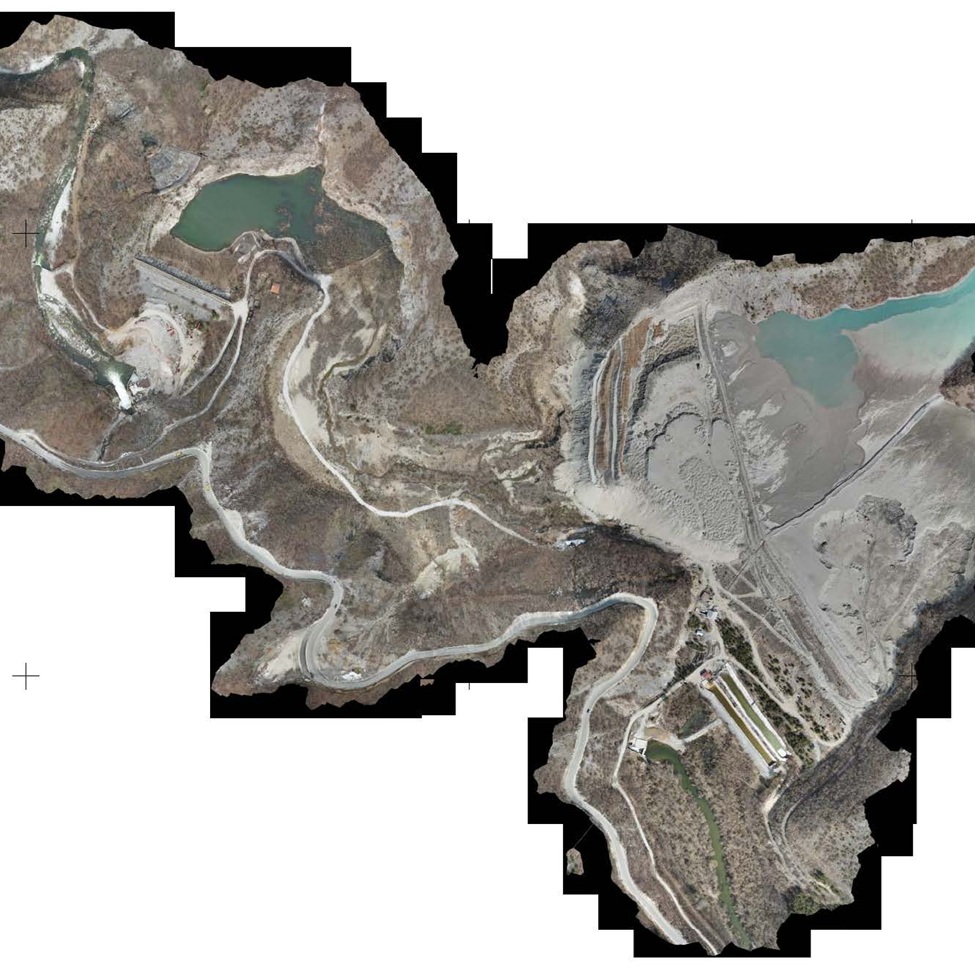
High-altitude digital photogrammetry, orthophoto generation, volumetric cut/fill computations, and environmental containment monitoring.
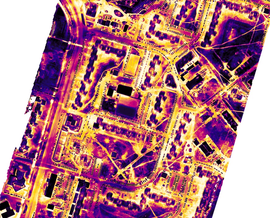
Airborne infrared thermography detecting underground pipe heat losses, insulation breaches, and structural anomalies in municipal utility corridors.
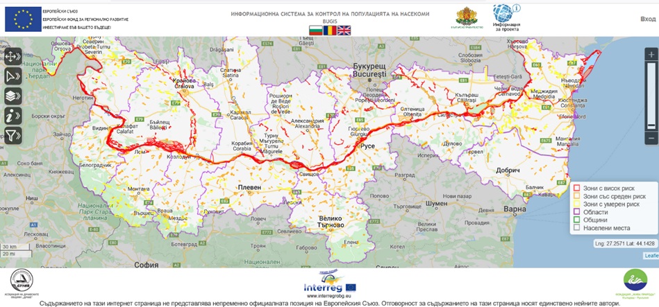
Large-scale geographical information systems structured for public administration, cross-border monitoring, and critical environmental assets.
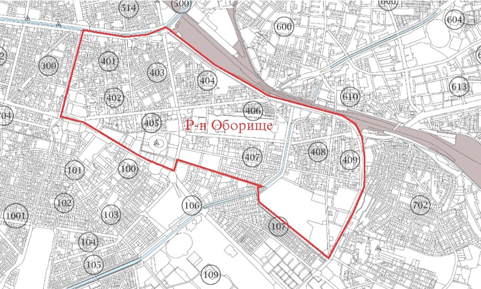
Comprehensive cadastre production, municipal boundary reconciliation, and urban zoning regulation plans for major metropolitan districts.
For engineering services, real estate valuations, infrastructure inquiries, or licensing partnerships regarding the SoarAqua® platform: